Lyuta lies at the foot of the Carpathian Mountains, about 25 miles (40 km) northeast of Uzhhorod and 362 miles (583 km) West-SouthWest of Kyiv. It is on the bank of the Liutianka River. The name of the village means snowyside/snowycorner because of the cold winters in the area. Its history dates back to 1599. The estimated population is under 4000 people.
Until 18 July 2020, Liuta belonged to Velykyi Bereznyi Raion. The raion was abolished in July 2020 as part of the administrative reform of Ukraine, which reduced the number of raions of Zakarpattia Oblast to six. The area of Velykyi Bereznyi Raion was merged into Uzhhorod Raion.[1][2]
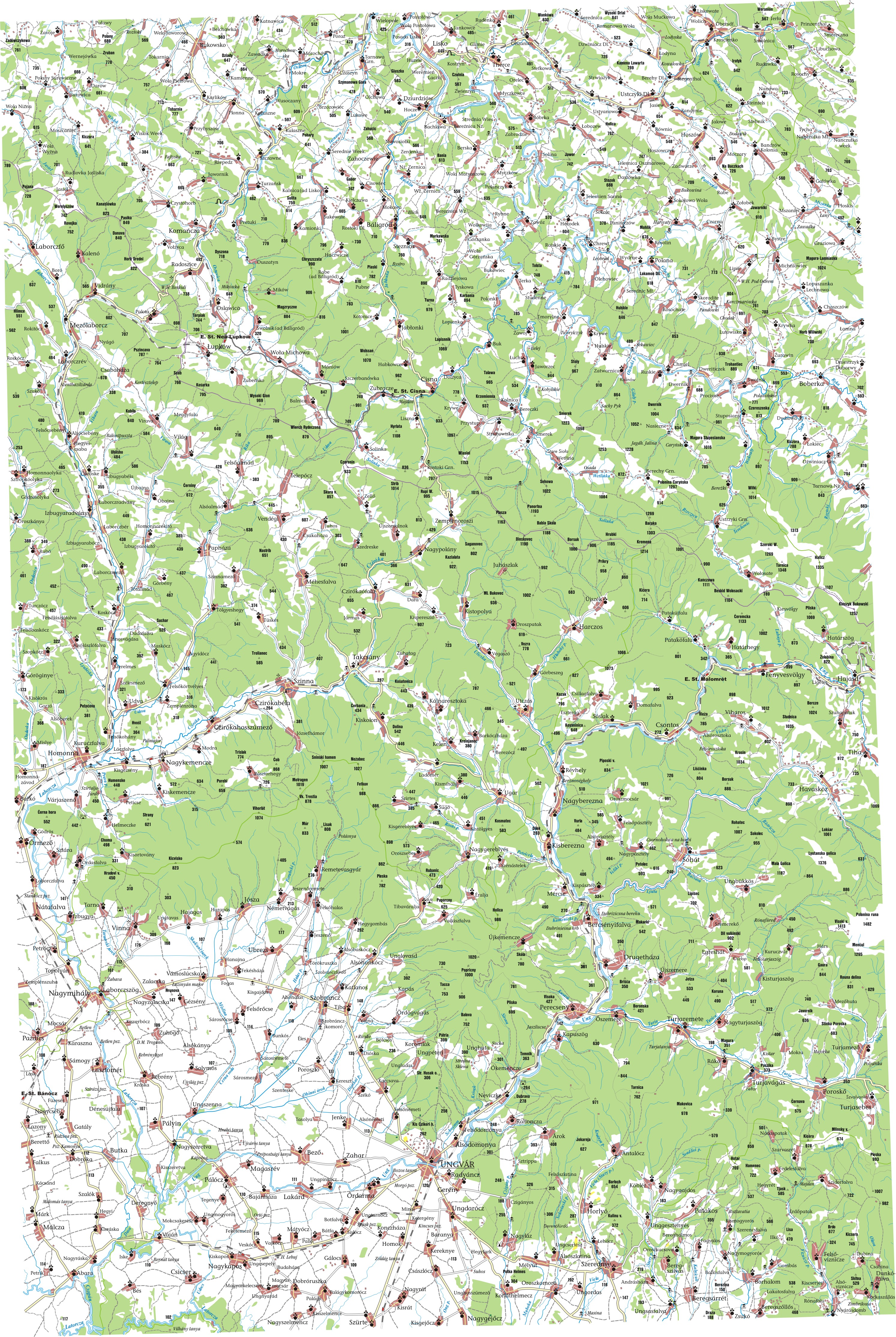
liuta, also, ljuta, ukrainian, Люта, hungarian, havasköz, small, village, located, uzhhorod, raion, zakarpattia, oblast, ukraine, Лютаhavasközcoat, armslocation, zakarpattia, oblastshow, zakarpattia, oblastlocation, ukraineshow, ukrainecoordinates, 90000, 7666. Liuta also Ljuta Ukrainian Lyuta Hungarian Havaskoz is a small village located in the Uzhhorod Raion of Zakarpattia Oblast of Ukraine Liuta LyutaHavaskozCoat of armsLiutaLocation of Liuta in Zakarpattia OblastShow map of Zakarpattia OblastLiutaLocation of Liuta in UkraineShow map of UkraineCoordinates 48 54 0 N 22 46 0 E 48 90000 N 22 76667 E 48 90000 22 76667Country UkraineOblast Zakarpattia OblastRaionUzhhorod RaionElevation540 m 1 770 ft Population Total2 412Time zoneUTC 2 EET Summer DST UTC 3 EET Lyuta lies at the foot of the Carpathian Mountains about 25 miles 40 km northeast of Uzhhorod and 362 miles 583 km West SouthWest of Kyiv It is on the bank of the Liutianka River The name of the village means snowyside snowycorner because of the cold winters in the area Its history dates back to 1599 The estimated population is under 4000 people Until 18 July 2020 Liuta belonged to Velykyi Bereznyi Raion The raion was abolished in July 2020 as part of the administrative reform of Ukraine which reduced the number of raions of Zakarpattia Oblast to six The area of Velykyi Bereznyi Raion was merged into Uzhhorod Raion 1 2 See also editCarpathian Ruthenia Carpatho Ukraine RusynsReferences edit Pro utvorennya ta likvidaciyu rajoniv Postanova Verhovnoyi Radi Ukrayini 807 IH Golos Ukrayini in Ukrainian 2020 07 18 Retrieved 2020 10 03 Novi rajoni karti sklad in Ukrainian Ministerstvo rozvitku gromad ta teritorij Ukrayini External links editMultiMap Current http uk2 multimap com M4 browse cgi scale 100000 amp lon 22 7667 amp lat 48 9000 amp icon X permanent dead link Detailed map 1910 Ung http lazarus elte hu hun tantort 2003 palyazat 40 49 ungvar jpg Further information http www fallingrain com world UP 0 Lyuta html nbsp This article about a location in Zakarpattia Oblast is a stub You can help Wikipedia by expanding it vte Retrieved from https en wikipedia org w index php title Liuta amp oldid 1091880363, wikipedia, wiki, book, books, library,